top of page
Remote Sensing and Environmental Hazard Analysis

Flash flood identification and analysis using Google Earth Engine
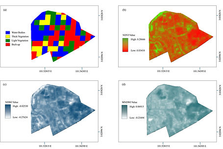
This paper highlights the need to improve Malaysia’s flood forecasting system, especially after the December 2011 flash floods in Taman Sri Muda. Read the paper
bottom of page